

Search
Or hit enter to search
Geospatial tools for mapping heat risk and prioritising resilient infrastructure investments
By Uttam Pudasaini, Director, Climate and DRR Technology Department, and Kundan Jung Thapa, Programme Coordinator, Urban Informatics Department, NAXA, Kathmandu, Nepal
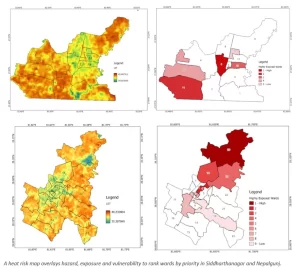
At NAXA, a youth-led GeoICT company based in Kathmandu, we have spent the past decade turning spatial data into decisions for disaster risk reduction, climate risk assessments and adaptation planning.
We understand that different data-driven, digital, and spatial tools and technologies add value across heat assessment and adaptation planning work.
Some of our recent key assignments illustrate this practice:
DASTAA (Digital and Spatial Technologies for Anticipatory Action) – where people, data, and technology converge: DASTAA is our in-house platform that brings this analysis down to a single facility or household, fusing field sensor readings, satellite analytics, and facility surveys into a tailored risk assessment, scorecard, and adaptation and disaster-response plan. We have generated such plans for roughly 35,000 flood-exposed households across Nepal and Bangladesh. Applied to heat, the same engine assesses each school, health post, or market on its own terms rather than an averaged ward statistic, so a clinic with no shade is treated differently from one beside a park. We are now integrating AI into DASTAA to close the gap between assessment and action. Today, producing an adaptation plan requires expert interpretation. With AI, the platform will read a facility’s sensor, satellite, and survey data and draft a tailored adaptation plan automatically, recommending shading, ventilation, cool roofing, water access, green cover, and adjusted working hours, refining its recommendations with each new assessment.
Disclaimer: The views expressed in this piece are those of the author/s and do not necessarily reflect the views or policies of AIDMI.
